ფაილი:Arabische Eroberung 2.jpg

ზჷმა გიწოთოლორაფაშ ბორჯის: 800 × 506 პიქსელი. შხვა გოფართაფა: 320 × 202 პიქსელი | 640 × 404 პიქსელი | 1,024 × 647 პიქსელი | 1,280 × 809 პიქსელი | 2,560 × 1,618 პიქსელი | 4,496 × 2,841 პიქსელი.
ორიგინალი ფაილი (4,496 × 2,841 პიქსელი, ფაილიშ ზჷმა: 3.36 მბ, MIME ტიპი: image/jpeg)
რეზიუმე
| ეჭარუა |
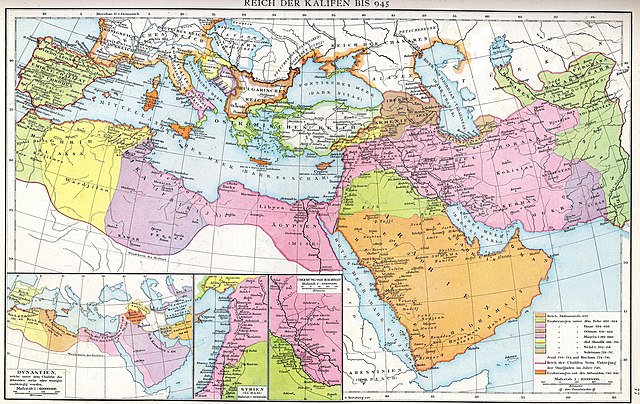
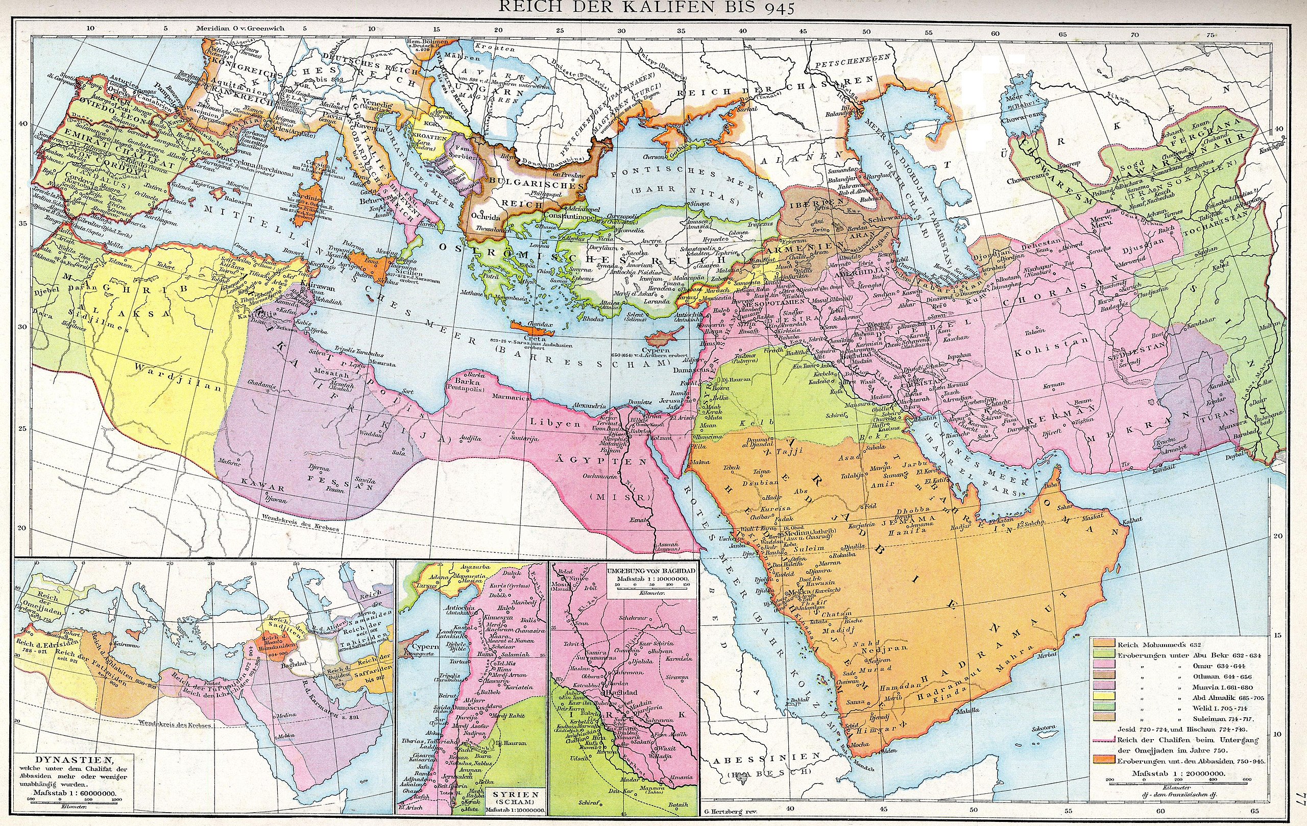
Deutsch: Das Reich der Kalifen bis 945. Karte aus dem Historischen Handatlas von Gustav Droysen, 1886
English: The empire of the Caliphs to 945. Map of the Historical Atlas of Gustav Droysen, 1886 |
| თარიღი | |
| წყუ | Gustav Droysens Allgemeiner historischer Handatlas in 96 Karten mit erläuterndem Text Bielefeld [u.a.]: Velhagen & Klasing 1886, S. 77. |
| ავტორი | Johann Gustav Droysen (6 July 1808 – 19 June 1884) |
| სხვა ვერსიები |
Derivative works of this file: |
.jpg)
ლიცენზირაფა
|
This work is in the public domain in its country of origin and other countries and areas where the copyright term is the author's life plus 100 years or fewer. This work is in the public domain in the United States because it was published (or registered with the U.S. Copyright Office) before January 1, 1929. | |
| This file has been identified as being free of known restrictions under copyright law, including all related and neighboring rights. | |
ფაილიშ ისტორია
ქიგუნჭირით რიცხვის/ბორჯის თიშო, ნამჷ-და ქოძირათ ფაილი თი რედაქციათ, ნამუ რედაქციას თი რიცხვის/ბორჯის რდუნ.
| რიცხუ/ბორჯი | ჭკუდი | გონზჷმილაფეფი | მახვარებუ | კომენტარი | |
|---|---|---|---|---|---|
| მიმალი | 17:23, 10 მარაშინათუთა 2012 | | 4,496 × 2,841 (3.36 მბ) | Cplakidas | larger & better quality |
| 04:51, 24 ფურთუთა 2007 |  | 2,187 × 1,389 (754 კბ) | Nikephoros | {{Information |Description=Karte des Kalifates vom Tode Mohammeds bis 945 |Source=Professor G. Droysens Allgemeiner Historischer Handatlas |Date=1886 |Author=G. Droysen |Permission=not necessary |other_versions= }} |
ფაილიშ გჷმორინაფა
თე ფაილი აკა ხასჷლას ვეგჷმირინუაფუ.
ფაილიშ გლობალური გჷმორინაფა
თე ფაილი გჷმირინუაფუ გეჸვენჯი ვიკეფს:
- ar.wikipedia.org-ს გჷმორინაფა
- az.wikipedia.org-ს გჷმორინაფა
- de.wikipedia.org-ს გჷმორინაფა
- de.wikiversity.org-ს გჷმორინაფა
- el.wikipedia.org-ს გჷმორინაფა
- en.wikipedia.org-ს გჷმორინაფა
- es.wikipedia.org-ს გჷმორინაფა
- fa.wikibooks.org-ს გჷმორინაფა
- fr.wikipedia.org-ს გჷმორინაფა
- id.wikipedia.org-ს გჷმორინაფა
- it.wikipedia.org-ს გჷმორინაფა
- ja.wikipedia.org-ს გჷმორინაფა
- ka.wikipedia.org-ს გჷმორინაფა
- ru.wikipedia.org-ს გჷმორინაფა
- sl.wikipedia.org-ს გჷმორინაფა
- sq.wikipedia.org-ს გჷმორინაფა
- sr.wikipedia.org-ს გჷმორინაფა
- tr.wikipedia.org-ს გჷმორინაფა
- ur.wikipedia.org-ს გჷმორინაფა
- uz.wikipedia.org-ს გჷმორინაფა
- zh.wikipedia.org-ს გჷმორინაფა